During the month of April there will be construction vehicles transiting the Klickitat Trail in Swale Canyon between trail mile 17 and 20 (Wahkiacus Trailhead to 3 miles south east). Please use caution.

CAMPING: About two miles east of the town of Klickitat, between SR142 and the River is a campground with a pit toilet called Klickitat Mineral Springs campground (aka the Ice House County campground). It is on the other side of the River from the Trail. Another camp spot is called Turkey Hole campground 5 miles up from the Lyle Trailhead on SR 142 also on the other side of the River from the Trail. There may be user fees. Wishbone campground is a private campground about a mile west of Lyle. There are several B-n-B’s in the area, a hotel in Lyle (Lyle Hotel), and a motel in Klickitat.
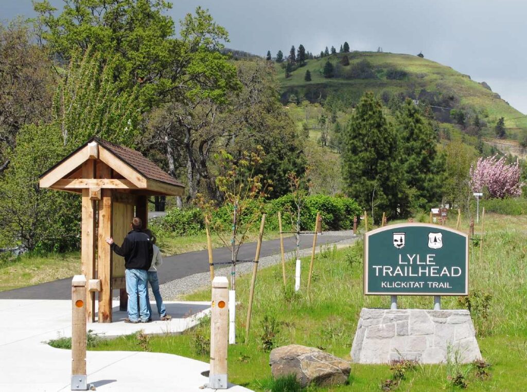
PARKING: You don’t need a permit to park at the Lyle Trailhead, but you cannot park there overnight or camp there. Most Washington State Parks require a Discover Pass but the Klickitat Trail does not because KTC donates hundreds of hours of volunteer time to help maintain the Trail all year around. As a State Park, it closes at dusk.

TRAIL SURFACE: Quite variable. Nice smooth rolled pea gravel in just two short sections: from Lyle to Fisher Hill bridge for about 1.7 miles; and in the town of Klickitat for just .5 miles. Except the trailhead at Lyle, no sections are paved. Many sections are mixed rock, dirt and plants; but vegetation is cleared away from the path. A couple sections are almost pure railroad ballast, which is the 3 or 4 inch rock that is packed around the rail and ties on a railroad. But the ballast rock is kind of packed down, so it is not too bad. There may be 2 or 3 miles max of that. There are no sections that are nasty jumbled bigger rocks, or eroded dirt piles, etc. It is a railroad bed, so there is a very uniform and gentle grade throughout.

HORSEBACK RIDING: Allowed on the entire Klickitat Trail, but right now the only practical area to ride is in the first 13 miles, between Lyle and Klickitat. Beyond Klickitat there is a section of undeveloped trail, and then in Swale Canyon there are nine trestles that are minimally decked.
Riders tell us that the best place to start is at Pitt, a little over 10 miles up the river from Lyle, and then ride back down toward Lyle. Pitt is the row of houses on the left after the mile 10 bridge on Hwy 142. To park, drive over the Hwy 142 bridge and go to the far end of the trailhead on your right, where there is a graveled loop. The parking here is less crowded than the Lyle Trailhead, and you have river access. From where you park, ride back past the row of houses on the other side of the road, and then cross the road just before the Hwy 142 bridge. Be careful at the road crossing! After crossing the road, continue by a gate onto the trail, and for the next lovely eight and a half miles there are no trestles and the road is on the other side of the river.
Depending on the season, you may encounter cattle. Please re-close any gates you find closed. When you get to the Fisher Hill Trestle it is decked and has guard rails for horse use, or alternatively you can cross the river on the Fisher Hill Road Bridge. Once across, it is another mile and a half to Lyle. For this last mile and a half the trail is on the same side as the road and below it. Riders have told us some horses get spooked by the road noises above them, so depending on your horse you might want to skip this section. There are more hikers and bikers in this section. Besides the more crowded Lyle trailhead, this overhead noise from the road is another reason you might prefer to start at Pitt rather than at Lyle.
It is also possible to ride north from Pitt about three miles to and through the town of Klickitat. Some of this is quite pretty. But besides being a shorter section, the trail is on the same side of the river as the road and in places close to the road.
The last half mile or so in Klickitat, from the school to the Activity Center, has recently been paved. For these reasons going south from Pitt is probably preferable.
We hope you enjoy exploring the trail on horseback, and please give us feedback and photos so we can improve our horse use description!
DOGS: Allowed on trail, BUT MUST BE LEASHED AT ALL TIMES.
DRONES: Can I fly a drone at state parks, including the Klickitat Trail?
Yes, on a limited basis and only with a permit. Permits are required for each instance of their use. A non-refundable application fee of $25 is due upon submission of a permit. 60 days in advance is recommended for permit application. Additional fees may be assessed.
For more information about the use of remote controlled aircraft as regulated within State Parks see WAC 352-32-130 (5) and WAC 352.37.170 (3), which allows for the flying of remote controlled aircraft with written permission of the director or designee.

NAVIGATING THE TRAIL: You can ride or hike all 31 miles. Be aware there is a three-mile stretch where you will not be on the Trail but on a county road, SR 142. Be sure to visit the website sections on Directions, Map, and Access Points for detailed assistance.
Going South:
The Trestle is out at Suburbia, east of Klickitat, so you have to go around. When you get to Wahkiakus, you must go onto the Horseshoe Bend Rd. and cross the Klickitat River going west to access SR 142 and then go south into the town of Klickitat.
Going North:
You can ride or hike the first 13 miles up from Lyle continuously on the easy-to-follow Trail. To continue, in the town of Klickitat, you will leave the Trail and follow the paved road SR 142, which is the main road from Lyle through Klickitat and on to Goldendale. You will take it for about 3 miles. Careful, there are no shoulders to this road. But there is not a whole lot of traffic either. Look for a right hand turn off SR142 called Horseshoe Bend Road. There is a bridge right over the Klickitat River. Look carefully at the directions on our map for finding the Wahkiakus trailhead. That is where you are headed. It is not far from where you left SR142, maybe a half mile. But there are several turns.
 EBIKES: Ebikes are not considered motor vehicles under Washington RCW title 46, so the agency has elected to also treat them not as motor vehicles for the purposes of our trail codes. So yes, ebikes are allowed. There is no speed limit for hikers, bicycles, runners, joggers, or horses. Be sure to observe Trail right of way signage posted at the Lyle trailhead.
 EAGLES: The month of January is traditionally prime time for large numbers of eagles, found usually in the lower two miles of the Klickitat River down to the mouth. Often they are on the sandbar where the Klickitat River flows into the Columbia.
SHUTTLE: We do not know of any shuttle services, but suggest you try calling Canyon Market, the grocery store in Klickitat at 509-369-4400. They may know of someone in Klickitat who would help you shuttle.
Click here to read past issues of KTC’s Trail Notes Newsletter
Learn more about Irvin Mitchell’s generous contribution to KTC
")
")
")
")
")
")
")
")
")
")
")
")
")